 
| Subject: | |
| From: | |
| Reply To: | A LISTSERV list for discussions pertaining to New York State history." < [log in to unmask]> |
| Date: | Fri, 25 May 2007 12:52:01 -0400 |
| Content-Type: | multipart/mixed |
| Parts/Attachments: |
|
|
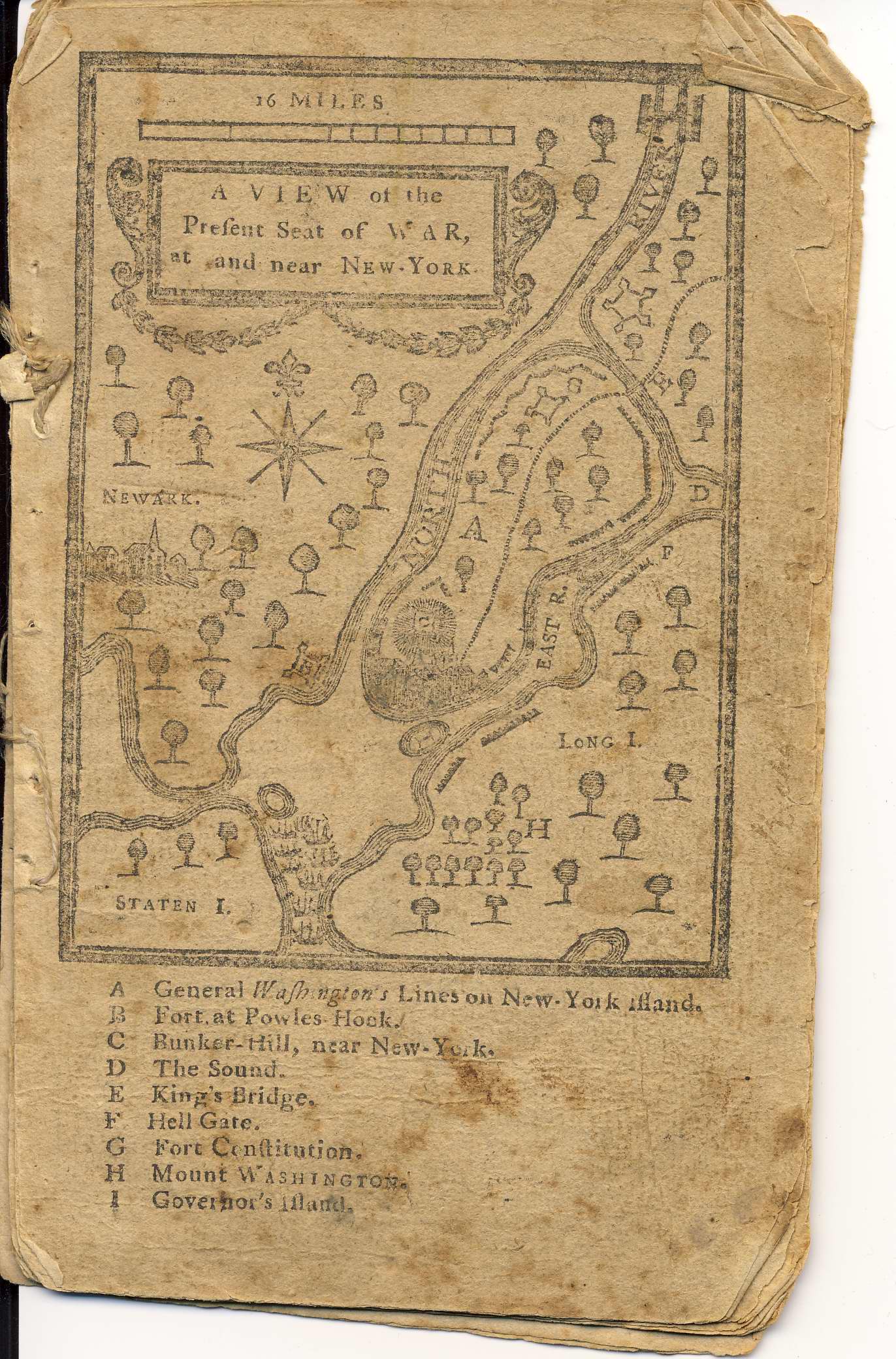
I don't know if this helps, but we have a Low's Almanac in our collection
from 1777 which features a map of the key war locations in New York.  I am
attaching a digital scan.


Best regards,

Emily Zucker

Curator, Bedford Historical Society


  _____

From: A LISTSERV list for discussions pertaining to New York State history.
[mailto:[log in to unmask]] On Behalf Of David Allen
Sent: Wednesday, May 23, 2007 4:22 PM
To: [log in to unmask]
Subject: [NYHIST-L] Maps in Public Buildings


I am investigating the distribution and use of maps in New York between 1750
- 1830.  One of the subjects that interests me is the extent to which maps
were displayed at that time in public buildings, such as taverns, libraries,
museums, and courthouses.  Does anyone know of  specific instances of maps
being put on public display at that time?  Any information at all would be
helpful.


David Allen

Encinitas, CA


  _____

See what's free at AOL.com <http://www.aol.com?ncid=AOLAOF00020000000503> .
|
|
|


